Balcones Fault
The Balcones Fault Zone is a tensional structural system[1] in Texas (USA) that runs approximately from the southwest part of the state near Del Rio to the north central region near Waco along Interstate 35. The Balcones Fault zone is made up of many smaller features, including normal faults, grabens, and horsts.[2] One of the obvious features is the Mount Bonnell Fault.[3]
The location of the fault zone may be related to the Ouachita Mountains, formed 300 million years ago during a continental collision. Although long since eroded away in Texas, the roots of these ancient mountains still exist, buried beneath thousands of feet of sediment. These buried Ouachita Mountains[4] may still be an area of weakness that becomes a preferred site for faulting when stress exists in the Earth's crust. The Balcones Fault zone was most recently active about 15 million years ago during the Miocene epoch. This activity was related to subsidence of the Texas Coastal Plain, most likely from the large amount of sediment deposited on it by Texas rivers. The Balcones Fault zone is not active today, and is in one of the lowest-risk zones for earthquakes in the United States.[5]
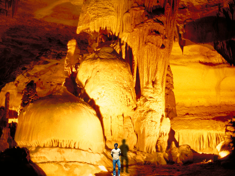
The surface expression of the fault is the Balcones Escarpment,[6] which forms the eastern boundary of the Texas Hill Country and the western boundary of the Texas Coastal Plain and consists of cliffs and cliff-like structures. Subterranean features such as Wonder Cave and numerous other smaller caves are found along the fault zone.
Many cities are located along this fault zone. Springs such as San Pedro Springs, Comal Springs, San Marcos Springs, Barton Springs and Salado Springs are found in the fault zone and provide a source of fresh water and a place for human settlement.
The Balcones Fault Zone[7] is a demarcation line for certain ecological systems and species distributions, e.g., the California Fan Palm (Washingtonia filifera) is the only species of palm tree that is native to the continental United States west of the Balcones Fault.[8]
[edit] See also
- Texas Hill Country
- Balcones Canyonlands National Wildlife Refuge
- Colorado River (Texas)
- Edwards Plateau
[edit] References
- ^ "Major Faults of the Edwards Aquifer". Edwards Aquifer. http://www.edwardsaquifer.net/faults.html. Retrieved 11 May 2010. Edwards Aquifer
- ^ Grimshaw, Thomas W.; Charles Woodruff, Jr. (1986). "STRUCTURAL STYLE IN AN EN ECHELON FAULT SYSTEM, BALCONES FAULT ZONE, CENTRAL TEXAS: GEOMORPHOLOGIC AND HYDROLOGIC IMPLICATIONS". The University of Texas. http://www.lib.utexas.edu/geo/balcones_escarpment/pages71-76.html. Retrieved 2008-10-27.
- ^ Hill, Robert T. (1891). "A brief description of the Cretaceous rocks of Texas and their economic uses". In E. T. Dumble. First Annual Report of the Geological Survey of Texas, 1889. Austin: State Printing Office. p. 134. http://www.lib.utexas.edu/books/landscapes/publications/txu-oclc-5235917-1/txu-oclc-5235917-1-b134a.html.
- ^ "Ouachita Mountains". J.S. Aber. http://academic.emporia.edu/aberjame/struc_geo/ouachita/ouachita.htm. Retrieved 11 May 2010. J.S. Aber
- ^ "Peak Acceleration (%g) with 10% Probability of Exceedance in 50 Years" (GIF). USGS. 2002-10. Archived from the original on 2007-06-27. http://web.archive.org/web/20070627054315rn_1/earthquake.usgs.gov/research/hazmaps/products_data/2002/2002April03/US/USpga500v4.gif.
- ^ Balcones Escarpment from the Handbook of Texas Online. Retrieved 11 May 2010. Texas State Historical Association
- ^ "Balcones Fault Zone". UT Austin. http://www.beg.utexas.edu/UTopia/centtex/centtex_what.html. Retrieved 11 May 2010. UT Austin
- ^ Hogan, C. Michael (2009-01-05). "California Fan Palm: Washingtonia filifera". GlobalTwitcher.com. http://globaltwitcher.auderis.se/artspec_information.asp?thingid=90942. Retrieved 2009-07-13.
[edit] External links
| |||

| ||
Go there...
http://en.wikipedia.org/wiki/Balcones_Fault
Endangered Species of the Edwards Aquifer
Aquatic species
Over 40 species of highly adapted, aquatic, subterranean species are known to live in the Edwards Aquifer. These include amphipod crustaceans, gastropod snails, and interesting vertebrates like blind catfish (Longley, 1986). Seven aquatic species are listed as endangered in the Edwards Aquifer system, and one is listed as threatened. The main problems for all the species are reduced springflows caused by increased pumping, elimination of habitat, and degradation of water quality caused by urban expansion.
The World Wildlife Fund has produced a must-have, authoritative reference work for anyone interested in endangered species. It describes 540 endangered or threatened species, including their habitat, behavior, and recovery. Excerpts from their Guide to Endangered Species and other sources were used to prepare this section. Information on the aquatic invertebrates was prepared using the US Fish and Wildlife's published final rule on listing the species.
The seven endangered species of the Edwards Aquifer system are:
- Fountain Darter (Etheostoma fonticola)
- Texas Blind Salamander (Typhlomolge rathbuni)
- San Marcos Gambusia (Gambusia georgei)
- Texas Wild Rice (Zizania texana)
- Comal Springs Riffle Beetle (Heterelmis comalensis)
- Comal Springs Dryopid Beetle (Stygoparnus comalensis)
- Peck's Cave Amphipod (Stygobromus pecki)
The threatened species is:
San Marcos Salamander (Eurycea nana)
In addition to the aquatic species that depend on Aquifer water itself, nine cave-dwelling invertebrates that live in the Aquifer's karst formations were listed by the US Fish & Wildlife Service as endangered in December 2000. There are three beetles, one daddy long-legs, and five spiders. In May of 2008 the Service released a Draft Recovery Plan (download it). For a general discussion on all these creatures see the section below on the cave-dwelling invertebrates.
- Rhadine exilis (no common name)
- Rhadine infernalis (no common name)
- Helotes mold beetle (Batrisodes venyivi)
- Cokendolpher cave harvestman (Texella cokendolpheri)
- Robber Baron Cave spider (Cicurina baronia)
- Braken Bat Cave meshweaver (Cicurina venii)
- Madla Cave meshweaver (Cicurina madla)
- Government Canyon Bat Cave meshweaver (Cicurina vespera)
- Government Canyon Bat Cave spider (neoleptoneta microps)
Texas Blind Salamander (Typhlomolge rathbuni)
Content on this page requires a newer version of Adobe Flash Player.
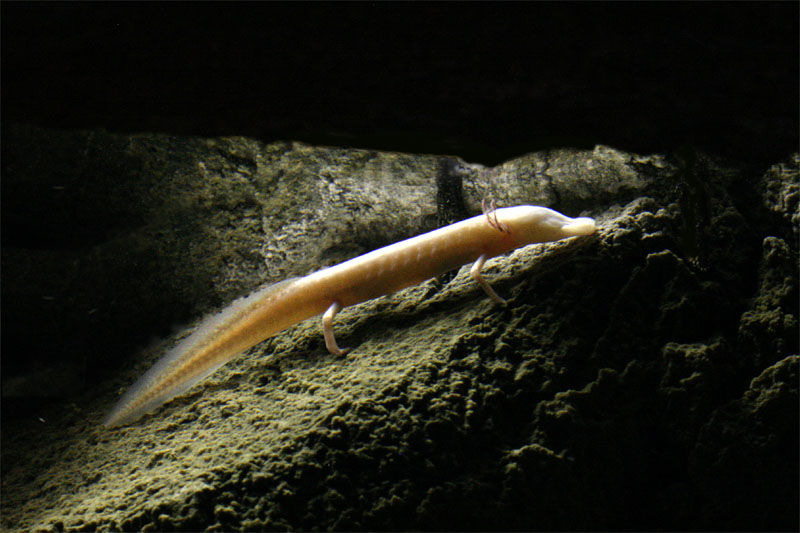 | A blind salamander stopping for a moment on a rock underwater. These are very difficult to photograph! |
Description:
Read More...
http://www.edwardsaquifer.net/species.html
The graphic above gives you an idea of the great number and complexity of the faults of the Edwards Aquifer. There's so many faults it makes you dizzy to look at them at this scale! There are places on this graphic where many small faults just kind of form a red blob.
Large faults act as barriers or partial barriers to groundwater flow; while smaller faults and associated joints form local and regional ground-water conduits. The graphic does not show the direction of dip, but for most of these faults it is toward the southeast. Note how most of the faults tend to run from southwest to northeast.
Read More...
http://www.edwardsaquifer.net/faults.html
Canyon Lake and the Guadalupe River
Canyon Lake is an impoundment of the Guadalupe River located 30 miles north of San Antonio. Waters of the Guadalupe provide no significant recharge to the Edwards Aquifer because the stream bed has been cut down below the level of the Edwards limestone. There is only one short stretch where the Edwards outcrop underlies the Guadalupe, and it is believed that during very dry times the Guadalupe may contribute recharge that emerges as springflow at San Marcos Springs (Woodruff and Abbott, 1986).
| Canyon Lake was built for flood control and water conservation, and for decades releases from the Lake have powered a series of small hydroelectric dams downstream on the Guadalupe River. Today, waters from Canyon Lake and the Guadalupe River have become an important component of regional plans to ensure an adequate supply of water for the 21st century. |
Early Settlement
Read More...
http://www.edwardsaquifer.net/canyon.html
In general the heat flow points derived from high-resolution temperature logs are consistent with the heat flow points obtained from BHT. Although the BHT data have a higher error range, the large number of BHT observations and the good coverage allow interpretation of detailed regional variations. The BHT data suggest that the low heat flow in the Fort Worth basin and north of Dallas are isolated features and that they are not linked to the low heat flow in Midland and Delaware basins, although the similar heat flow values for Fort Worth and Midland basins suggest similar kind basal heat flow. The 50 mW/m2, contour level inferred from BHT data extends in the west towards Palo Duro basin, but its exact position in this area is not very well constrained because of poor coverage of the BHT data in the area in between. Therefore we interpret the 51 mW/m2 value for the Palo Duro basin as a transition zone between the low heat flow in Midland Basin, and the higher heat flow immediately north of Amarillo uplift.
Read More....
http://geology.heroy.smu.edu/~negraru/Heat_texas/
- Fault Lines in Texas
- fault line in texas - Google Search
- Map of Texas area fault lines
- Heat Flow in Texas
- Faults and Caves
- Canyon Lake and the Guadalupe River
- Endangered Species of the Edwards Aquifer
- Endangered Species of the Edwards Aquifer
- Texas Cave Management Association | TCMA | Conservation | Education | Study
- 1-026.jpg (JPEG Image, 800x600 pixels) - Scaled (93%)
- Balcones Fault - Wikipedia, the free encyclopedia
No comments:
Post a Comment